COMPASS ULTIMATE V2 is available!
New: GNSS functionality, waypoint functions, TMH function, WMM 2025
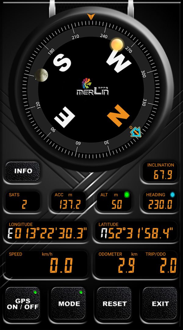
The completely newly developed app COMPASS ULTIMATE attempts to expand and unite a conventional compass with today's technical possibilities of a smartphone. The result is a very appealing and successful 3D symbiosis that completely transforms your smartphone visually.
In addition to the usual determination of direction by means of the gyroscopes built into the smartphone, undreamt-of possibilities arise in connection with GNSS. All this is possible without a connection to the mobile phone network or the Internet, because the use of common online services for location determination has been dispensed with as a matter of principle. With COMPASS ULTIMATE, even an older smartphone without a SIM card can still be used. Whether this happens on a bike tour, hiking or while geocaching, if done by train, car or on a plane or boat is up to you.
COMPASS ULTIMATE can also be used to measure distances travelled, determine the exact GPS position, speed and altitude.
New in version 2:
- TMH (TAKE ME HOME)
TMH is a newly integrated navigation function that guides the user directly to the destination using aerial navigation. The distance and direction to the destination point are displayed. This function is supported by a completely new integrated waypoint management system. This makes COMPASS ULTIMATE the first choice for geochaching.
- WMM 2025
The Worldwide Magnetic Model support already available in the previous version has been updated with the latest available model (COV file WMM2025).
In addition, the software is flexibly configurable, supports the most common units of measurement worldwide and is also visually customisable by the user. Several graphical vector layouts are available, and the shape and colour of the displays can be changed. As a feature, the position of the sun (including twilight display) and the moon (including moon phases) can also be displayed if desired. The globally valid magnetic model of the earth (WMM) including predictable local deviations is integrated. This makes COMPASS ULTIMATE a compass of the 21st century.
Supported satellite navigation systems:
BEIDOU, GALILEO, GLONASS, GPS, QZSS, SBAS
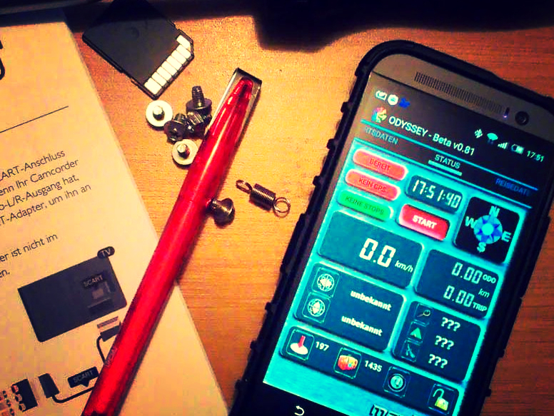
ODYSSEY-Version 0.95xp is available!
ADDITIONAL HIGHLIGHT :
ODYSSEY - the travelling companion
ODYSSEY is an app for everyone travelling a lot professionally or privately and shall record his daily routine for later analysis. The ANDROID app combines in a unique way all the relevant distance and time measurements and will be your reliable companion. Forget handwritten notes with phone numbers and notes on mileage or time spent at the customer's location. Your expense report at the end of the month will be a no-brainer using ODYSSEY, because the software is able to remember everything and provide you with a ready-made report. ODYSSEY is also fun and adaptable in a variety of ways to personal needs and preferences. ODYSSEY is a mixture of logbook, triplogger, customer database and timecard. The app changes your smartphone visually, you won't just see boring numbers but an "ODYSSEY-device" in 3D design. All you need is a functional ANDROID smartphone with GPS. ODYSSEY is the ideal app for a meaningful revival of your old smartphone!